 McCoy Wynne
Triangulation
This work is from the ongoing project to visit all 314 primary triangulation points that were built and measured between 1936 and 1962 by the Ordnance Survey for the Retriangulation of Great Britain. The work will provide a comprehensive survey of the British landscape and deals with issues of mapping, representations of the landscape, the layering of history, land use, ownership and boundaries. Even though the location of each pillar is well documented, there is still a heightened sense of exploration and anticipation based on the uncertainty of access, weather conditions and the disparity between “the real” and the “abstract” of the map view.
The majority of the pillars are no longer used in mapping, having been superseded by GPS, but have become totemic as markers in the landscape.
We have now established a coherent working method by using the concrete pillar as the reference point and by placing the camera directly on top of the pillar to make the 360 degree panorama of the topographical view. We tried a number of camera and lens combinations, but decided on a 24 mm PC Nikkor, with a tripod head to keep the camera level. The first few times we tried placing the camera without a tripod on the pillar, but it was difficult to rotate the camera and keep the horizon straight.
No doubt we have been influenced by the work of landscape photographers who are analytical rather than “pictorial”. The work of survey photographers who where employed to be as objective as possible and the work of the New Topographic photographers ( maybe they should be called Old Topographic now ) with their reliance on description and typology, has informed this work. Also, the fact that the viewpoint has been predetermined for us reduces the decision making about “what is a good photograph ?” and the effects of cultural / educational baggage.
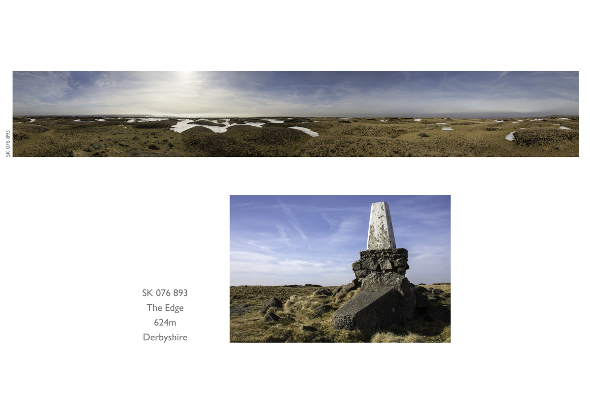
One of the most recent triangulation points we attempted to photograph was “The Edge” in Derbyshire. We went with the writer Kenn Taylor who is collaborating with us for a forthcoming exhibition and although the point is close to The Pennine Way, we couldn’t find it. The problems were that the pillar was not visible from the path, there was snow on the ground and visibility was quite poor.
By the time we established it’s location, after advice from a couple of National Park Rangers, the weather had deteriorated and more snow began to fall.
We returned a week later and found it without any problem and the image is below.
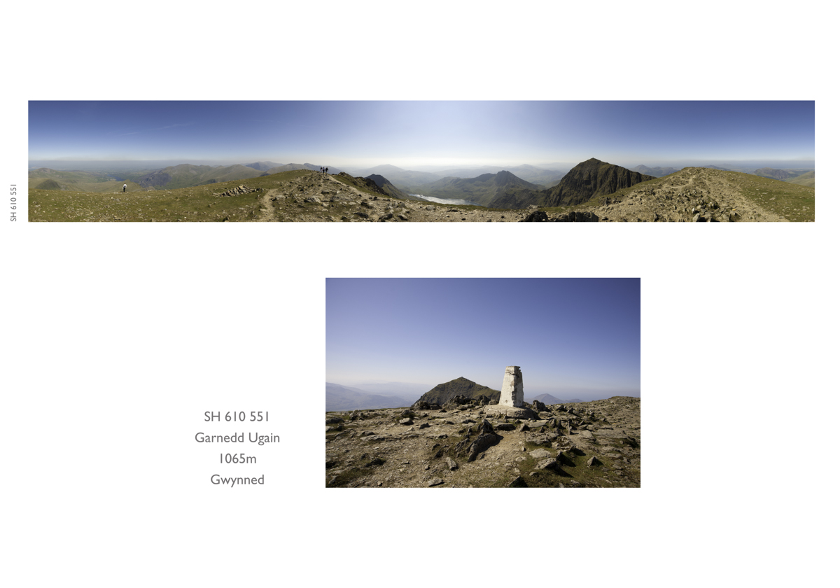
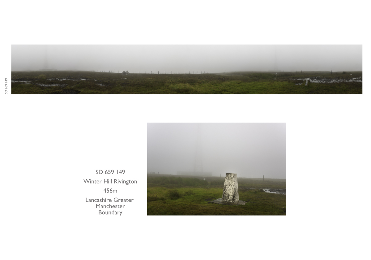
One of the elements that is difficult to sense from the photographs is wind. Most of the points are exposed and the strength of the wind can difficult to deal with.In particular the photograph of Garnedd Ugain, next to Snowdon, was taken in a howling gale. Although it was sunny the wind was so strong we had to put all our weight on the the tripod head and camera on top of the point to prevent them from blowing off. We’ve photographed in all weather conditions and even if the view is negligible, rain and mist are just as valid as sun and blue skies.
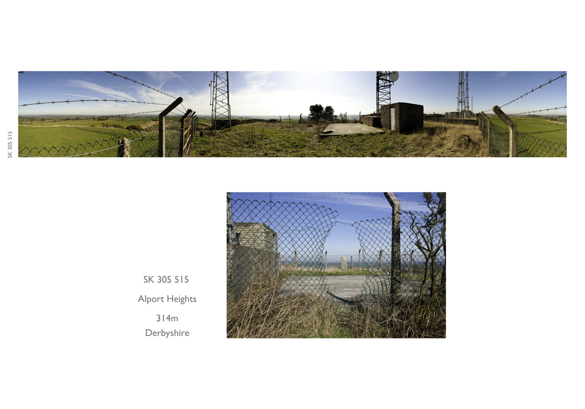
Access can also be a problem and the trig point at Alport Heights was next to phone masts and surrounded by a security fence. Fortunately, somebody ( not us), had made a hole through the fence and we were able to gain access.
A selection of the work will be on show at The Cornerstone Gallery from 7th June.
A gallery of the 22 trig points photographed so far is here